Friday, September 03, 2010

Christchurch earthquake pictures


Christchurch earthquake
Originally uploaded by johnstewartnz.
(way down at the bottom are quake preparedness commentary and a video)

Earthquake!

Earthquake!
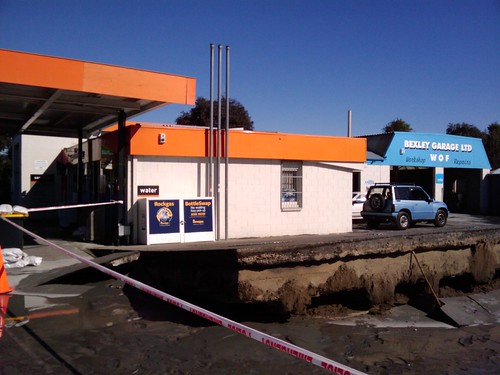
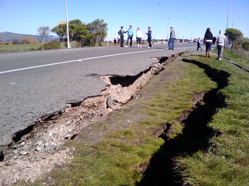
(Look at that vertical displacement!)
(edit: A couple of friends have since reminded me that "displacement" is a specific geologic term with regard to quakes. This offset might not be ground displacement as much as separation due to liquefaction or localized sinking.)

Earthquake!

Earthquake!

Earthquake!
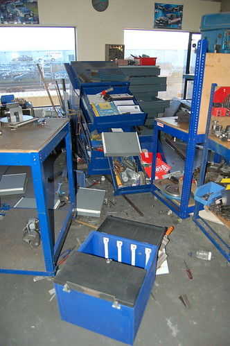
(above photos by digitalsadhu

Christchurch earthquake

Christchurch earthquake

Christchurch earthquake

Christchurch earthquake
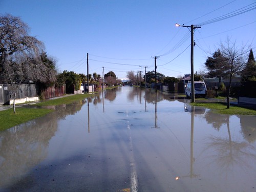
(above photos by John Stewart

Christchurch Earthquake Works a mess

Christchurch Earthquake Works a mess
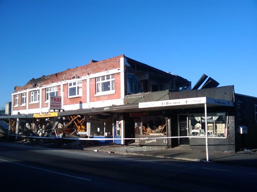
(above photos by Brendan Gloistein


After I looked at these, I reminded my husband that we haven't replaced the attachment hardware for our bookshelves, so we'll do that this weekend.

We also need to re-inventory our quake kit and find out what we need to replace. My favorite list of supplies is sfgate.com.

Folks from Christchurch respond to last night's big quake:


The panicky woman couldn't have known then (and many folks don't know, in general) that the quake wasn't really big enough for a tsunami, especially given as it was centered under land. They're usually from bigger quakes centered under water, with specific seismological conditions. But when the ground has bounced you out of bed in the wee hours of a winter's morning, that's probably not your first thought.

there's a lot going on down there

It's not exactly as good as being on the ISS, but it's still amazing:


Timelapse of Earth from low orbit. The lights below, the aurorae, just lovely. I want to lie in the cupola and stare.

Thursday, September 02, 2010

Earl: Now, in AQUAVISION

Aquavision-Hurricane-Earl-20100902-0000Z

Oh, how neat is this? The blue shows water vapor, or as the caption states:

Aquavision False color image from GOES-E Satellite taken on September 2, 2010 0000 UTC.

RGB[IR4, IR2, WV] composite. In the image Category 4 Hurricane Earl moves northwest towards a frontal system draped across the North America that had deformed in to a straight wall. The blue water vapor outflow of Hurricane Earl swoops down to the SW, while the overall flow of the frontal system moves water vapor from the tropical system near Baha California up towards Greenland.


Image credits: EUMETSAT / NEODASS / DSRS / NASA / processing by Mike Malaksa

A beer company chimes in on saving the Colorado

And I find this just as a friend from New Mexico tells me of some rather horrible water conservation mayhem in her neck of the woods, so I'm going to get on top of some research -- oooh, content. This blog might have content!


(Note: On a scale of NSFWness, this is a 3 on a 1-10 scale, where 1 is Mister Rogers.)

Hurricane Earl from Space

Hurricane Earl takes up a huge chunk of planet. Regardless of whether the eye makes landfall -- and it still seems likely that the track will curve to the north then east, and miss land -- this is going to make one heck of a stormy Labor Day Weekend on the east coast of North America.